
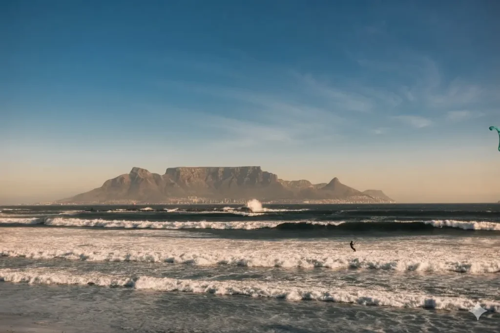
Ask anyone who’s lived in Cape Town for more than a summer, and they will tell you the same thing. “The wind runs the city’s social calendar more than the weather forecast does. A 28°C day can be unusable if the south-easter is gusting at 45 km/h. While a cooler, still morning after a cold front can be the best beach day of the month. Understanding why Cape Town’s wind behaves the way it does makes it far easier to plan a day out. Knowing which direction sends people where is better than simply hoping for the best.
Why Cape Town is So Windy?
Cape Town’s located at the tip of a narrow peninsula. It’s squeezed between the Atlantic Ocean on one side and False Bay on the other. Table Mountain and its range run straight through the middle. That geography is the whole story. Wind that would pass through an open plain elsewhere gets funnelled, compressed and accelerated as it moves around the mountains. This is why the city often feels far windier than the regional forecast suggests.
In summer, a high-pressure system called the South Atlantic High sits off to the south-west. Air flows around it in a slow anticlockwise circle. On the eastern edge of that circle, where Cape Town happens to be, the flow comes from the south-east. That’s the wind locals call the south-easter, or the Cape Doctor.

In winter, the pattern flips. Cold fronts roll in off the Atlantic from the north-west, bringing the rain. Cloud and the strong north-westerly winds define a Cape Town winter. It’s also what fills the region’s dams and turns the mountains green. So, the same wind that cancels a beach day is doing useful work in the background.
The South-Easter, or Cape Doctor
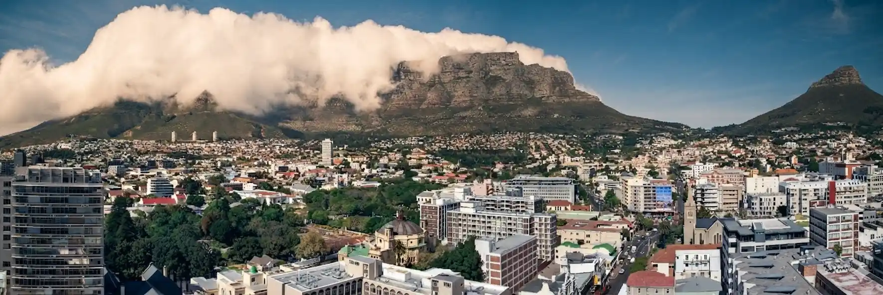
The south-easter is the wind Cape Town is best known for. It blows mainly from October to March, most persistently in November and December, and can hold steady for two or three days at a time. Locals call it the Cape Doctor. This is because of an old belief that it “cleans” the city. Blowing smog, dust and stagnant summer air out to sea.
The wind picks up moisture as it crosses False Bay, then slams into the Cape Peninsula’s mountains. Some of that moist air gets pushed up the back of Table Mountain, cools as it rises, and condenses into cloud right along the summit. As the cloud spills over the front of the mountain and drops into warmer air below, it evaporates again. This is what produces the “tablecloth.” That dramatic sheet of cloud pouring over the flat top without ever quite reaching the city below.
Souther-Easter Strongest in the Afternoon
The south-easter is strongest in the afternoon, when the land has heated up and the pressure difference between land and sea increases. Wind speeds in Table Bay have been recorded as high as 160 km/h during particularly strong events. Though a “normal” south-easter is closer to 30–50 km/h with higher gusts. On the Atlantic Seaboard, it accelerates as it funnels down off the mountain. This is why Camps Bay, Clifton and Sea Point can be unpleasant to sit still in even when the rest of the city feels calm.
There’s a variant worth knowing: a black south-easter. It’s the same wind direction, but loaded with cloud and rain instead of blue skies. It sounds as bad as it sounds. Expect overcast and damp conditions at the coast despite the gusts. It’s a different experience to the clear, dry Cape Doctor days most people picture.
The North-Wester and Winter Storms
From roughly May to September, the dominant wind flips to the north-west, arriving ahead of and during cold fronts pushing off the Southern Ocean. These systems bring the bulk of Cape Town’s annual rainfall. They’re accompanied by big Atlantic swells, rough seas and, on the stronger fronts, gale-force gusts. Ferries to Robben Island are often cancelled on these days, and Table Mountain’s cableway closes when gusts get too high.
A north-wester is generally worse news for outdoor plans than a south-easter. This is mainly because it comes with rain and low cloud rather than just wind. It’s also the wind direction that makes False Bay beaches, usually the shelter of choice in summer, uncomfortable. You don’t want to be facing almost directly into it. Rather stay home or go to the V&A Waterfront.
Two More Local Winds Worth Knowing
A berg wind is a hot, dry wind that flows down off the interior plateau towards the coast. It warms further as it descends. It typically arrives a day or two ahead of a cold front and can push temperatures into the 30s°C even in a cool season, along with a sharp rise in fire risk. If Cape Town suddenly feels like midsummer in the middle of July, this is usually why.
The term black south-easter, mentioned above, refers to a south-easter accompanied by heavy cloud and rain rather than the clear-sky version most visitors expect.
Which Beach is Sheltered Today: The Basic Rule
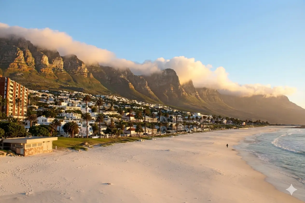
Because of the peninsula’s shape, the two coastlines almost never have the same conditions at the same time. On a south-easter day, False Bay is the place to be. The wind blows over the peninsula’s spine and out to sea before it reaches beaches like Muizenberg, St James, Kalk Bay, Fish Hoek, Simon’s Town and Boulders, all of which stay comparatively calm while the Atlantic Seaboard is blown out.
On a north-westerly or northerly day, the pattern reverses. Those winds hit False Bay directly, so Camps Bay, Clifton and the rest of the Atlantic side become the more sheltered option, weather and swell permitting. In a full winter cold front with a strong north-wester, there usually isn’t a comfortable beach anywhere on the peninsula, and it’s worth planning an indoor day instead.
Where the Wind is an Advantage, Not a Problem
For kitesurfers and windsurfers, the south-easter isn’t something to avoid, it’s the entire point of coming to Cape Town. Big Bay and Kite Beach at Table View sit on a stretch of coast that runs roughly parallel to the wind direction, so riders get a clean, consistent cross-shore wind of around 20 – 35 knots. That allows them to power across the wave face for long stretches rather than fighting an onshore chop. It’s consistent enough that Cape Town hosts international kitesurfing events during the peak summer months. This draws competitors specifically for this wind pattern. Langebaan, an hour and a half up the West Coast, offers a flatter, more sheltered lagoon version of the same wind for those who want less swell and more speed.
Sailors on Table Bay and in the Waterfront’s small-boat harbours plan around the same forecast. Expect a building south-easter through the afternoon, easing off after sunset. Paragliders launch off Lion’s Head or Signal Hill and depend on a readable, steady wind direction. The south-easter usually provides this, though the same consistency that makes it good for kiting can make it too strong for paragliding. Especially true once it fully establishes itself in the afternoon.
Practical Tips for Visitors
- Check the wind before committing to a beach day, not just the temperature. A hot, sunny forecast on the Atlantic Seaboard can still mean sandblasted skin and unusable beach umbrellas if the south-easter is up. Most weather apps show wind speed and direction alongside temperature; if the wind is south-easterly and above about 25–30 km/h, head to False Bay instead.
- Mornings are calmer than afternoons in summer. The south-easter typically builds through the day and peaks in mid-to-late afternoon, so an early swim, walk or breakfast on the Atlantic side often beats waiting until 2pm.
- Table Mountain’s cableway is wind-dependent. It generally closes when wind at the summit exceeds around 60 km/h, or gusts pass roughly 90 km/h. Aim for calm, clear mornings as the safest bet for a booking. A strong south-easter or north-wester forecast means it’s worth having a backup plan.
- Hold onto hats, hire-car doors and anything loose. A brisk south-easter is strong enough to catch an unlatched car door or take a sun hat off a table, and construction sites and building sites sometimes close cranes during the worst gusts.
- Pack a windbreaker even in summer. Cape Town’s daytime temperatures can be warm while the wind still makes exposed spots, especially along the Sea Point promenade or the Waterfront, feel considerably cooler than the thermometer suggests.
If you’re planning water sports specifically for the wind, kitesurfing, windsurfing or dinghy sailing, the summer months from November through February give the most reliable south-easter, while June to August is cold-front season and better suited to storm-watching or big-wave surf spectating than anything requiring calm water.
FAQ:
The city sits on a narrow peninsula between the Atlantic Ocean and False Bay, Table Mountain runs through the middle. Wind that would pass through open ground elsewhere gets funnelled and compressed by this terrain, which accelerates it. In summer that funnelling effect combines with the South Atlantic High-pressure system to produce the south-easter. In winter it’s cold fronts moving off the Atlantic that bring strong north-westerlies.
It’s the local name for Cape Town’s summer south-easterly wind. So called because it was traditionally believed to blow pollution and stagnant air out of the city. It blows most consistently from October to March and tends to be strongest in the afternoon.
November and December usually bring the most persistent south-easter, sometimes holding for two or three days straight. Winter has its own strong winds too, but these arrive with cold fronts every few days. They’re intermmittent rather than a sustained daily pattern.
Yes, April and May, in the shoulder season between the summer south-easter and the winter storms. These months tend to have calmer, more variable conditions. This is also generally regarded as a good time to visit for milder, more settled weather overall.
Check the wind direction before picking a beach. On a south-easter, False Bay beaches such as Muizenberg, Kalk Bay and Fish Hoek stay sheltered. The Cape Doctor blows out the Atlantic Seaboard. On a north-wester, that reverses, and the Atlantic side becomes the calmer option.
Yes. The cableway typically closes when wind at the summit passes around 60 km/h, or when gusts exceed roughly 90 km/h. Calm, clear mornings offer the best chance of a booking running as planned. This is particularly true during a strong south-easter or a winter cold front.
It’s a hot, dry wind that flows down from the interior plateau towards the coast, warming further as it descends. Berg winds usually arrive a day or two before a cold front. They can push temperatures into the 30s°C even outside summer, along with a sharp increase in fire risk.
Yes, and this is one of the main reasons the sports are so established here. Big Bay and Kite Beach at Table View run roughly parallel to the south-easter. This gives riders a clean, consistent 20 – 35 knot cross-shore wind rather than a messy onshore chop.